Preparation
Choosing a route:
Eastern Route – takes in Ethiopia, South Sudan and Northern Kenya. Currently this route is too dangerous to travel.
Central Route – previously the route of choice for Overlanders, tour operators and year off students, this journey passes through either Algeria or Libya, down to Niger (or Mali) and then Nigeria, crossing the heart of the Sahara including the Hoggar Mountains. But this route is currently closed as Algeria will not generally issue visas, and Libya is still extremely dangerous; as is Niger and northern Nigeria.
Western Route – hugs the Atlantic coast all the way from Morocco to South Africa, passing through 20 countries (Guy crossed all of them except Equatorial Guinea). Security issues remain in a number of these countries.
Key considerations:
Visas: The one requirement to be factored in at an early stage was the need to go from city to those locations where consulates could be found, most often in capital cities, to acquire the necessary visas for onward travel. Not every country requires a visa, but most do. Some can be purchased at the border on entry, but many had to be obtained in advance requiring an embassy visit and were very date specific. Prices ranged from negligible to extortionate.
Road Conditions: Road surface and quality were also an important consideration. Much of road along the eastern route was paved although not necessarily in good condition. Potholes are a common occurrence and the biggest concern regards potential damage to the vehicle.
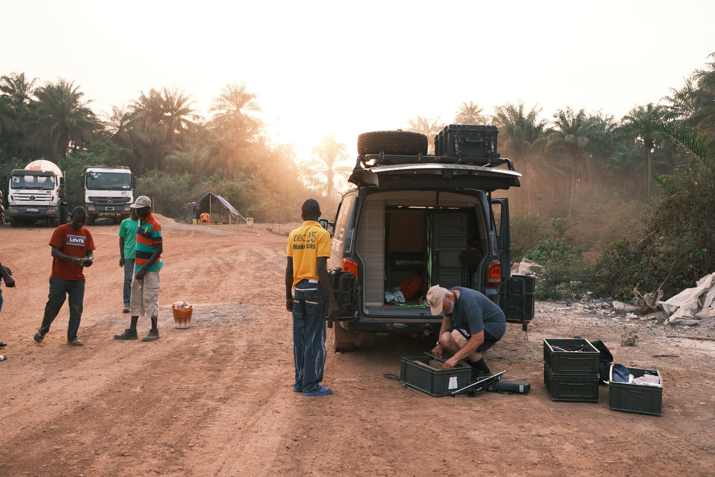
Diesel, Food & Water: Service stations selling Diesel were commonplace, sometime accepting credit cards or having an ATM on site (albeit many not working), and they often incorporated a poorly provisioned but useful shop. ‘Total Bonjour’ were plentiful in former French colonies. Water is available widely and sold by the bag, with bottled water being available in every food shop or stall.
Accommodation: As a planning assumption, Guy aimed to spend four days of every week wild camping (in a safe and secure location), two nights in a camp site, and one night in a B&B or hotel, thereby providing the right balance of independence and adventure, while also providing Guy with enough comfort and convenience to maintain his stamina for the long journey. In the event, for the bulk of the journey, there were no camp sites but plenty of small hotels.
Navigation, Communication & Media Capture
Navigation: Guy’s view was that “As long as I was heading south, I was travelling broadly in the right direction”. Map reading was not difficult except when off the beaten track. Guy relied on Michelin maps for north and south Africa for planning, and ‘Maps.me’, ‘ioverlander’, ‘Earthmate’ by Gsrmin as well as gogglemaps for navigation on the go.
Communication & Media Capture: Mobile phone coverage was available for much of the route. When entering each new country, Guy would buy a local sim card and some local credit (understanding the tariffs proved frustratingly difficult). Photography was captured through…. (TBC); and for video footage, Guy used… (TBC). Film maker, Rob Howard from New Fruit Productions joined Guy at different stages of the journey for filming opportunities.
Raising Awareness of Parkinson’s in Africa: Guy collaborates closely with Parkinson’s organisations worldwide, in particular with Cure Parkinson’s Trust and Parkinson’s UK. He has forged particularly strong links with Parkinson’s Africa, working with Omotola Thomas, Founder & Director, to establish contact with Parkinsons’s sufferers and medical experts in Africa, and to maximise media opportunities throughout his journey.